
St. Paul has made remarkable strides in recent years expanding its network of protected bikeways. New trails along Como Avenue, Wheelock Parkway, Johnson Parkway, and Ayd Mill Road have dramatically improved safety and access for cyclists of all ages and abilities. Much of this growth has been focused on routes that are primarily aimed at recreation, like parts of the Grand Round.
But, like Minneapolis, St. Paul also has a host of terrible bikeways, missing links, and crashes waiting to happen. Many fail to live up to their potential due to pavement condition and poor design while others are functionally obsolete from the moment they’re built.
Here’s a rundown of the capital city’s worst offenders.

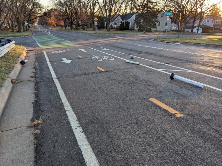
Prior Avenue North of University
A few years ago, the city painted bike lanes along an industrial stretch of Prior Avenue which hosts popular venues like BlackStack Brewing and Can Can Wonderland. The lanes narrowed the street and, along with new 25 MPH speed limit signs, helped calm traffic.
But the lanes themselves are painted over a pitted concrete moonscape of cracks and potholes more suitable for a mountain bike course than a commute. And weaving around wheel bending obstacles isn’t the only challenge. Cyclists must also dodge semi trucks, abandoned cars, and even the occasional food truck taking up residence in the bike lane. Prior’s lanes are narrow, too—near Pierce Butler, they’re just 2½ feet wide. But don’t worry, drivers get a lane that’s 21-feet wide here.
Worst of all, look out for cars entering and exiting the Menards parking lot. That guy who just tied a sheet of plywood to the top of his Subaru with plastic twine is definitely not looking out for cyclists.

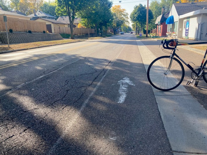
Minnehaha Avenue West
This bike lane checks all the bad boxes: Terrible pavement; multi-block gaps; completely vanishes in winter; ample opportunity to get doored; un-calmed traffic; double-parked cars and wide school buses.
The real shame is that Minnehaha would easily be one of the most useful east-west routes across Frogtown and Midway if it were more inviting. It connects with many other bike routes and should really serve as a vital part of the bike network. But it’s best to avoid Minnehaha in almost all situations and opt for slower but far more comfortable neighborhood streets.
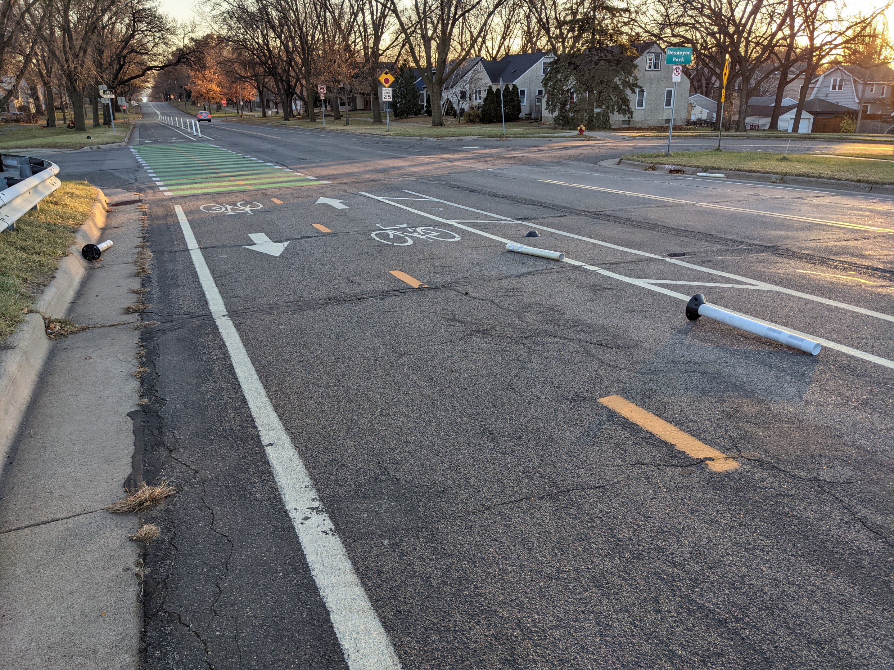
The Bollarding of Pelham
As one of the few on-street protected bikeways in St. Paul, Pelham Boulevard bridges a gap in the Grand Round and connects several neighborhoods with the Mississippi River—an example of what could be a great bikeway. But Pelham’s pavement quality is bad, plastic bollards are regularly knocked down by cars, and several intersections encourage dangerous vehicle speeds thanks to wide corners. To add insult to injury, each fall several neighboring homeowners rake their leaves directly into the bike lane.
Marshall Avenue’s Wayward Journey
Marshall could be a fantastic east-west connector, but its bike lanes disappear east of Lexington into a pitted surface of wheel-destroying crags. The roadway is still wide until Victoria, but apparently having a center turn lane on a relatively low-traffic neighborhood street is more important than continuous bike lanes, because St. Paul ¯\_(ツ)_/¯.
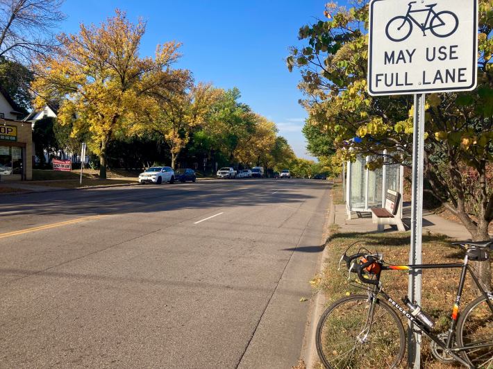
Near the river crossing from Minneapolis, many people dread the “Marshall Hill,” not just for the elevation, but because you’re riding uphill in a narrow lane sandwiched between parked cars and racing drivers trying to beat each other to a lane merge after having the whole Lake Street bridge as an acceleration zone. Going downhill, you get a couple rare “Bikes May Use Full Lane” signs instead of a bike lane. Despite having another full lane to pass, drivers still periodically throw a temper tantrum that cyclists have the audacity to exist.
Pennsylvania Avenue’s Dead End
St. Paul’s fundamental missing link is the complete lack of safe infrastructure connecting its east and west sides. By far the worst example is Pennsylvania Avenue, a mile of pitted urban highway with zero shoulder and no sidewalk. There’s plenty of room for a trail, too. But it inexplicably ends just west of I-35E, unavoidably suggesting to both cyclists and pedestrians the ’70s ear worm “You Left Me Just When I Needed You Most.”
A slightly less terrifying detour is to ride Jackson north and cut east on Cayuga, which has less traffic but also features a bike lane that disappears at the I-35E interchange. Just when you needed it most.
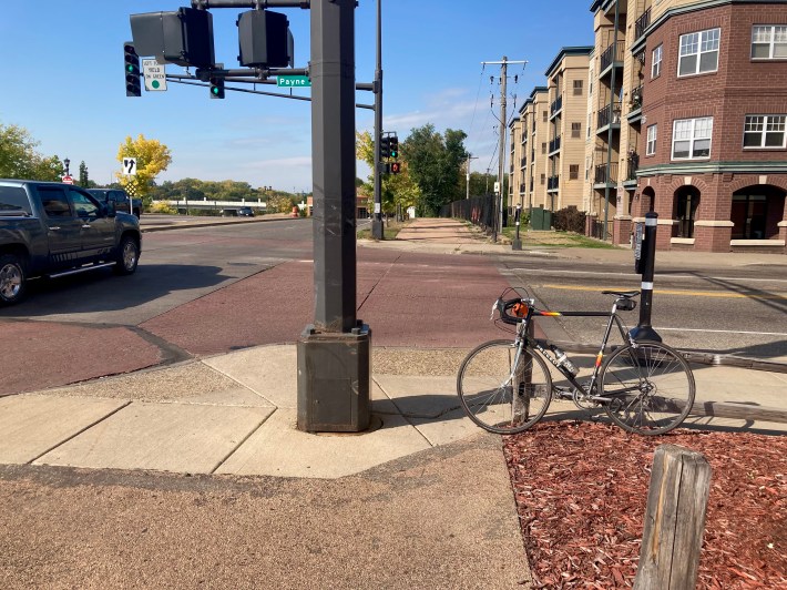
The Intersections of Phalen Boulevard
A ride along Phalen Boulevard might make you doubt whether engineers ever go back and actually look at the facilities they design. The worst offender is the stoplight post at the intersection of Payne and Phalen. Directly in the middle of the trail, cyclists have to either veer out into traffic, or squeeze through the narrow gap in the path.
All along Phalen, you’ll find a whole host of terrible crossings with narrow, misplaced, jarring curb cuts, punctuated by drivers rolling through stop signs without looking. Phalen’s bad design generates frequent reports of cyclists getting hit and a string of close-calls for riders at almost every corner. Frustratingly, most of these issues could have been avoided if the trail had been built instead along the south side of Phalen Boulevard.
Cleveland Avenue’s Ghost Bike Lanes
One of the city’s few contiguous north/south bike routes, Cleveland Avenue’s bike lanes magically disappear and reappear along its four mile run between University Avenue and the Mississippi. North of 94, they’re non-existent despite plenty of space on the street. From 94 south to Eleanor in Highland Park, Cleveland sports a painted lane which is often blocked by Amazon delivery trucks. (Read this essential NYT/HuffPo/ProPublica deep-dive on Amazon's horrific impact on our streets.) Strangely, even though the paint is only a few years old, it’s already fading into nothingness, especially near Randolph Avenue.
Faded bike lanes are a problem throughout St. Paul. According to Sean Kershaw, the city’s public works director, the fundamental issue is that the city’s road maintenance budget hasn’t kept up with cost increases. The city must balance bike lane markings against the need to repaint center lines, crosswalks, parking lanes, etc. Making matters worse, the city’s long line pavement striping machine frequently breaks down, and funding is not yet in place for a replacement.
South of Eleanor, Cleveland’s bike lanes revert to sharrows. Share the road, friends!
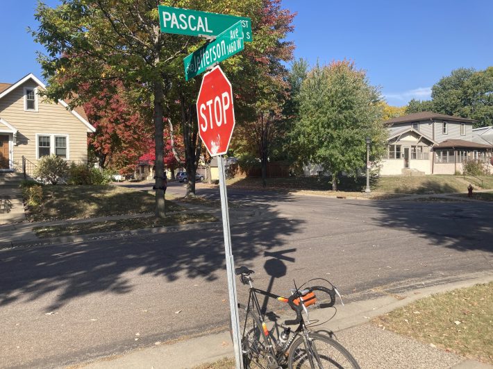
Jefferson Avenue: NIMBY Bikeway
Jefferson Avenue runs through the heart of the wealthy Macalester-Groveland neighborhood, a mostly calm residential street which would have been a perfect east-west bike route. Instead, when city planners proposed such a route, a handful of vocal opponents managed to derail the entire project. Today, instead of concrete traffic diverters or curb extensions, Jefferson sports little bicycle pictures on its street signs, a single traffic circle, and a handful of painted sharrows between the river and Lexington Avenue. Many riders have reported being harassed or yelled at by impatient drivers. Best advice: Take care not to inconvenience any minivan drivers on the Jeffway.
East of Lexington, Jefferson finally gets both some narrow painted lanes and a profusion of potholes as it steeply descends toward West Seventh Street. Tighten those axel quick releases before riding down that hill!
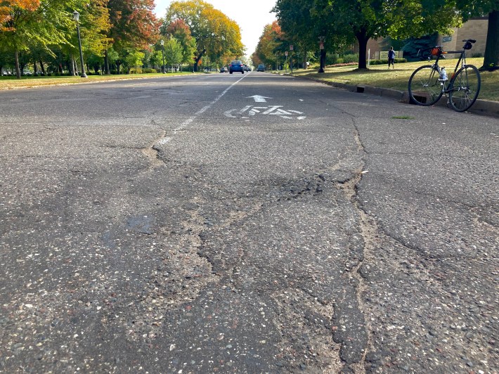
Summit Avenue, That Old Rocky Road
Recently, much ink has been spilled regarding bikes on Summit. Even with the narrow, crack-filled lanes from the Hill House to Lexington, the Victorian jewel of St. Paul streets still sees more bike traffic than any other street in the city. Just imagine what a safe, comfortable route, just one block north of the Grand Avenue commercial corridor, connecting four higher education institutions, and offering the easiest route to downtown St. Paul could look like.
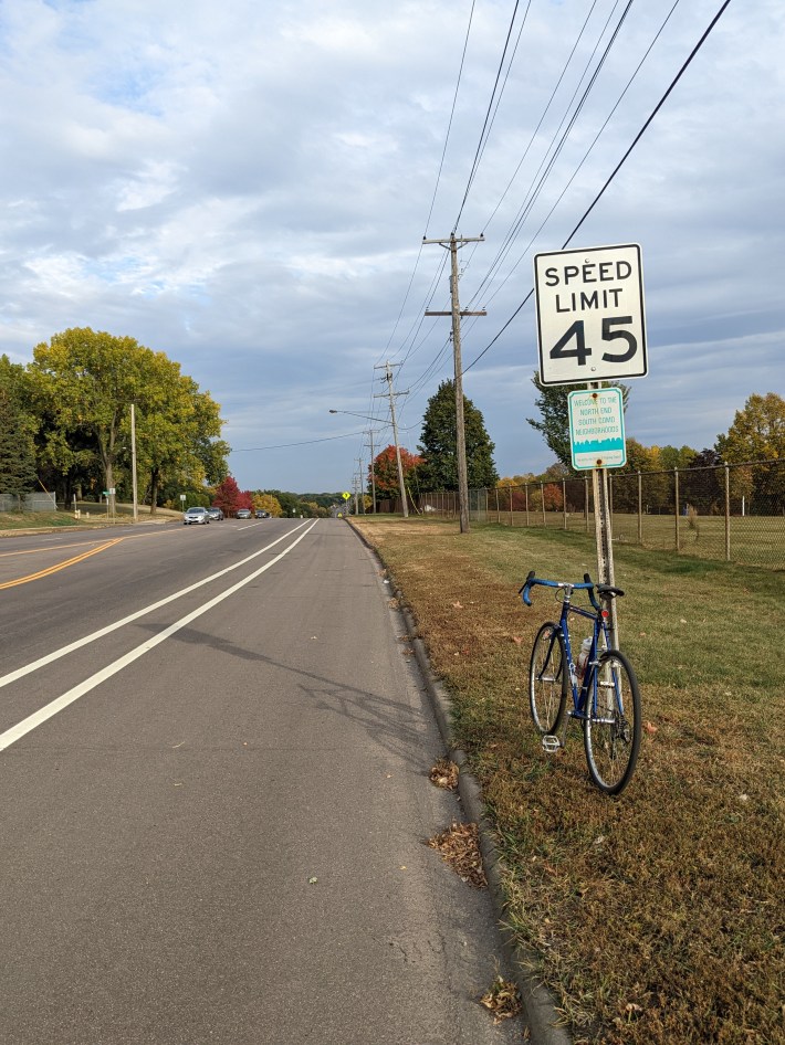
Speeding the Borderline on Larpenteur
Do you enjoy riding in an unprotected bike lane next to 45 MPH traffic? Want that bike lane to randomly end, dumping you into traffic before a major intersection? Love having aggro truck bros get mad at you for simply existing and using a well-marked crosswalk, swerving around a yielding driver, almost driving over the median island to hit you? Then Larpenteur is the bike lane for you! In all seriousness, the bike lanes here are part of a generally good trend toward road diets on Ramsey County roads.
But that doesn’t mean the bike lanes do much at all to make the routes better for cyclists. These lanes provide only the thinnest veneer of bike-friendliness. In the stretch of Larpenteur between Victoria and Rice, at least two people have died already this year, one pedestrian and one driver, sadly the inevitable result of having roads with such deadly speeds next to homes, business corridors, parks, and schools. How many more need to die before Ramsey County engineers and electeds finally prioritize safety over speed?
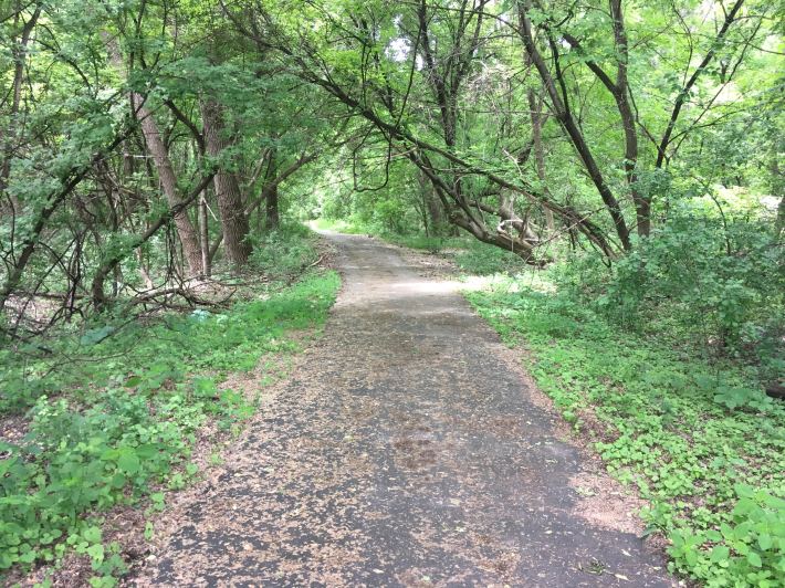
Honorable Mention: Fish Hatchery Trail
No list of bad bike infra in St. Paul would be complete without Fish Hatchery Trail, which is both objectively terrible and yet peaceful—and hugely fun to ride. Serving as the only safe connection between the eastside neighborhoods of Highwood and Battle Creek to downtown, activists have struggled for years just to keep the trail open. Built on unstable ground, the trail suffers from washouts, sinkholes, and a roller coaster ride of frost heaves through a remote wooded area along Highway 61. Part of the trail is just a patch of eroding gravel.
Yet, for all that, the trail also offers a rare glimpse of nature in the midst of the city. Deer and other wild critters are a common sight. Just be sure to hang on to your handlebars.
Fish Hatchery is in some ways poetically representative of cycling in St. Paul writ large. Biking is such a joyous, fulfilling way to get around the city. On any given day, you’re likely to bump into friends and neighbors, see a diversity of wildlife, and get treated to amazing vistas over the Mississippi River gorge. You’ll bask in the endorphins of moving under your own power and intimately experience the changing seasons. To make these experiences accessible to many more people, the city must continue to invest in truly safe infrastructure that protects cyclists from traffic violence.